Linda and I recently boondocked near an abandoned mine off the Darby Well Road southwest of Ajo. Over the next two days I climbed Sauceda Benchmark and Black Mountain (Pima) while Linda explored the area on bicycle and foot. It was a sheltered and pleasant campsite.
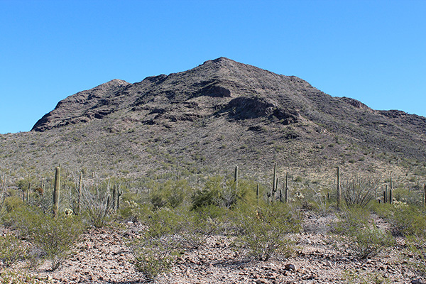
My goal the second day was to climb Black Mountain, rising just to the south of our campsite. I know of four Black Mountains with at least 1000 feet of prominence in Arizona. This Black Mountain has 1328 feet of prominence and lies in the Little Ajo Mountains of Pima County south of Ajo. The northern slopes appeared quite steep from our campsite but some friends had found a good route up its southwest ridge that I intended to try.
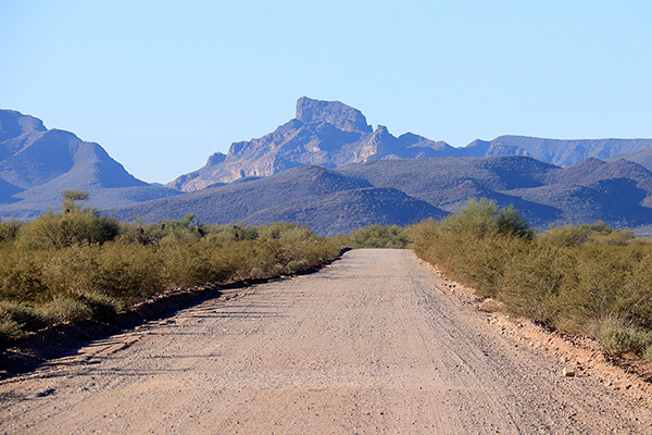
However, I began my second day by exploring road access to nearby peaks. I drove Darby Well Road west then Bates Well Road south towards Kino Peak, which I someday hope to climb. Bates Well Road was well graded and I had a good view of Kino Peak from the road. I expect driving to Bates Well would go well.
Rather than continuing all the way to Bates Well I turned west and explored road access to Gro Benchmark, the highpoint of the Growler Mountains. I followed roads west until I came to the Cabeza Prieta National Wildlife Refuge boundary, where private vehicles were prohibited to continue. I had hoped to drive further. From this point hiking to the summit of Gro Benchmark and back would be 15 miles.
It was time to return for my climb of Black Mountain. I drove back towards our camp and pulled off Bates Well Road below its southwest ridge. Black Mountain appeared to be a straightforward climb and I expected the ridge climb and the traverse to the summit to go quickly.

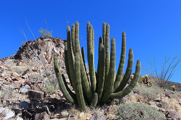
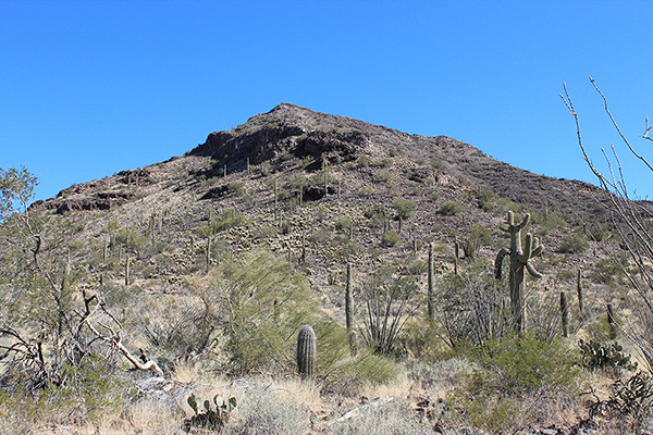
After a short hike I began climbing the base of the southwest ridge. I climbed a slope through a field of Teddy Bear Cholla and passed by a beautiful organ pipe cactus.
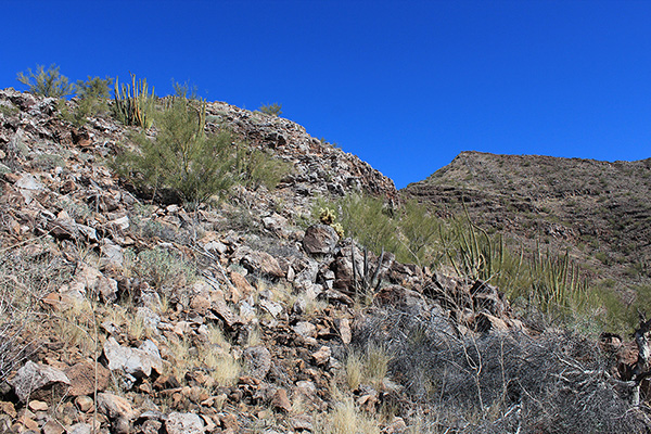
Higher on the ridge I discovered the crest was quite rocky with steep faces, broad ledges, and short gullies. But the slopes were stable and I was able to stay near the crest and enjoy the climbing. As I climbed I stopped often to take photos.
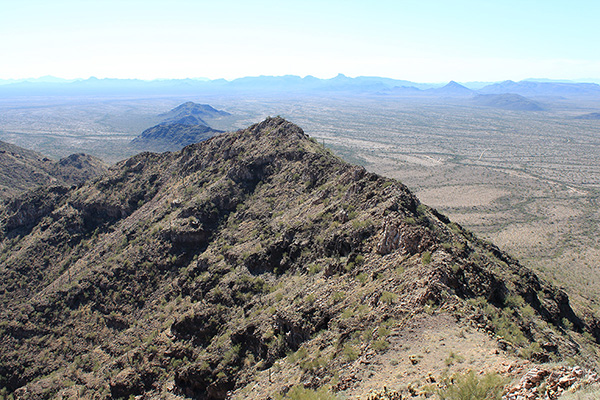
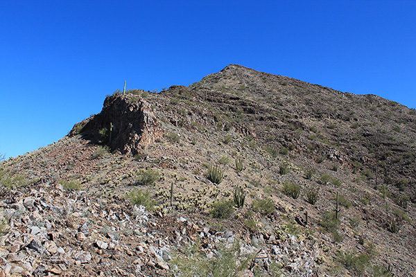
Once I reached the top of the southwest ridge I expected an easy walk over to the summit, but discovered, instead, a narrow traverse along a rocky crest. Again, I stayed near the crest and enjoyed the scrambling, though it took longer than I had expected to reach the summit.
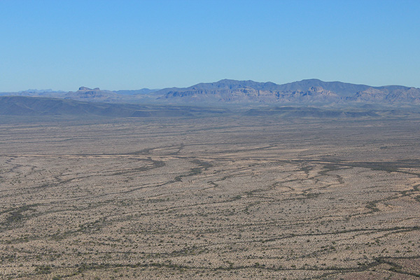
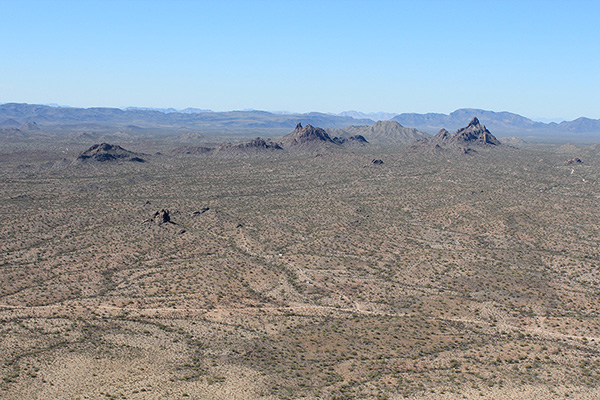
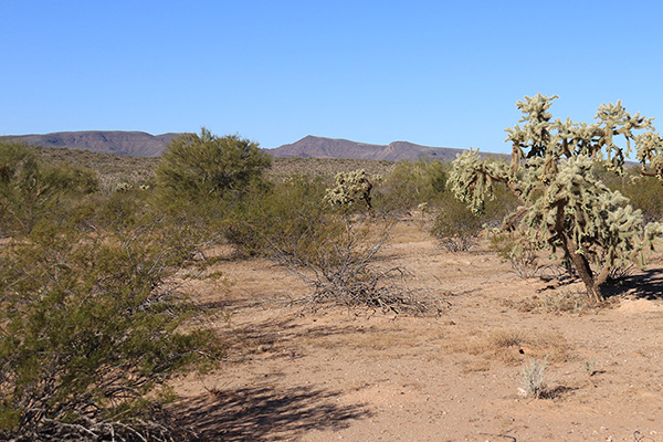
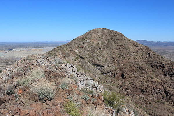
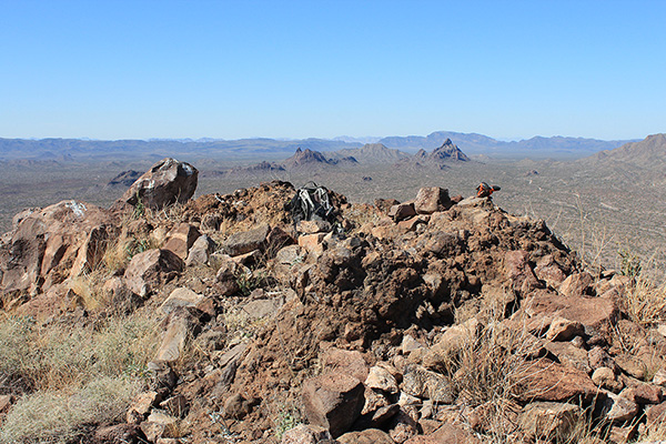
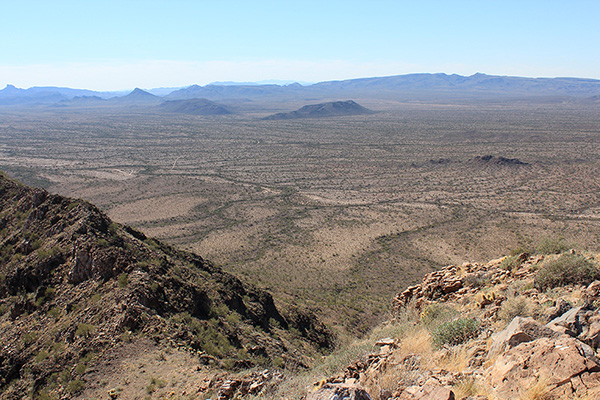
I had the mountain and the roomy summit to myself. I enjoyed the views of many surrounding mountain ranges and peaks, including Sauceda Benchmark, which I had visited the day before, and Kino Peak, Gro Benchmark, Growler Peak, and the distant Ajo Range.
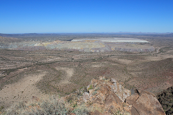
The New Cornelia Mine and tailings stretched out to the north with the city of Ajo beyond. In the foreground I identified our campsite partially hidden behind trees and brush. I ate lunch and looked for a summit register, but found only an empty jar with two pencils nearby.
I descended the same route to my Jeep, seeing if I could more faithfully follow the crest down. At one spot on the traverse I climbed around a gendarme. At another spot on the ridge I descended to the left around a cliff face along the crest. Otherwise, the crest was fun to descend.
Black Mountain is prominent and accessible, my route was enjoyable, and the summit is very scenic. Climbing it was a day well spent in the desert.

Leave a Reply