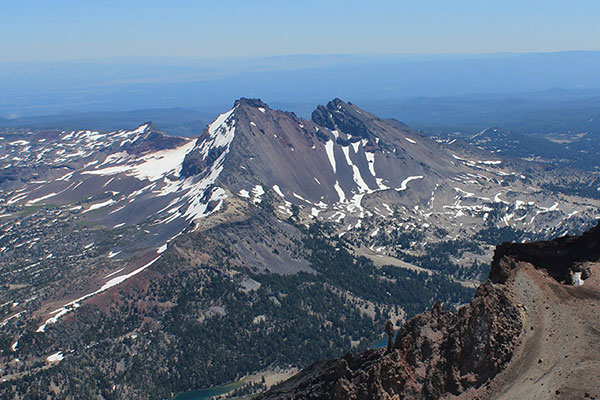
On Wednesday, September 30, Bob F. and I climbed Broken Top, just southeast of the South Sister in Deschutes County. Broken Top is an extinct Pleistocene stratovolcano that last erupted about 100,000 years ago. It has been greatly eroded during subsequent ice ages and has steep ridges of resistant but dubious rock. Broken Top still possesses two diminished glaciers, the Bend Glacier on the northern slopes and the Crook Glacier in the southern cirque. It is the 23rd highest peak in Oregon and the 56th most prominent.
This was my fourth climb of Broken Top, my last climb in August of 2003. Bob had only climbed it once before, when he was in middle school in 1971. It is interesting how distorted memories become after the passing years. Clearly remembered landmarks on routes may not exist, unexpected ones appear, or easily climbed pitches seem much harder on subsequent visits. It was time to return for both of us.
After several weeks of hazardous smoke I was desperate to get out in the forest and mountains. I badly needed exercise in clean air. The day before I had worn myself out on a mountain bike ride but hoped I was up for the climb with Bob the next day. I certainly felt the effects of that bike ride on the climb.
The Ascent
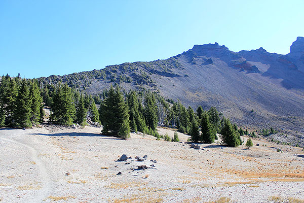
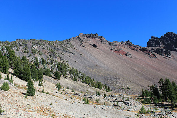
We started the climb at the Green Lakes Trailhead. We followed the trail along Falls Creek to Green Lakes, then found a well worn climbers trail leading northeast towards the northern (true) summit of Broken Top. This climbers trail was easy to follow and led to a saddle low on the northwest ridge of Broken Top.
The trail climbed the northwest ridge up to a basalt wall just below the steep summit block of Broken Top. This was a slow climb for me and twice I had to stop to nurse a threatening leg cramp. Eventually we arrived at the basalt wall. I had lunch, rehydrated, and cleared my mind for the climb ahead.
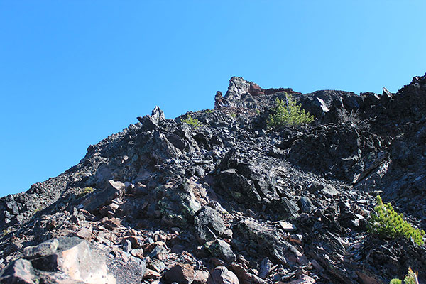
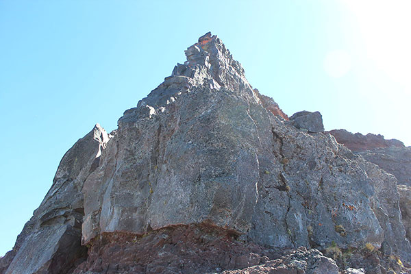
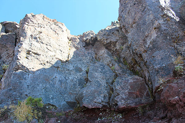
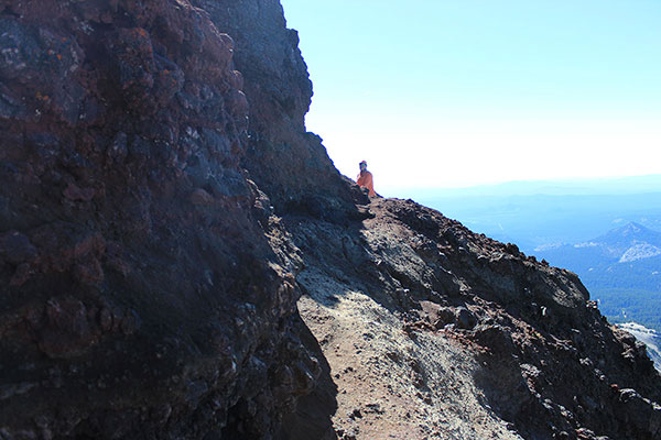
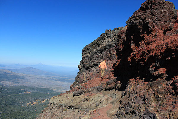
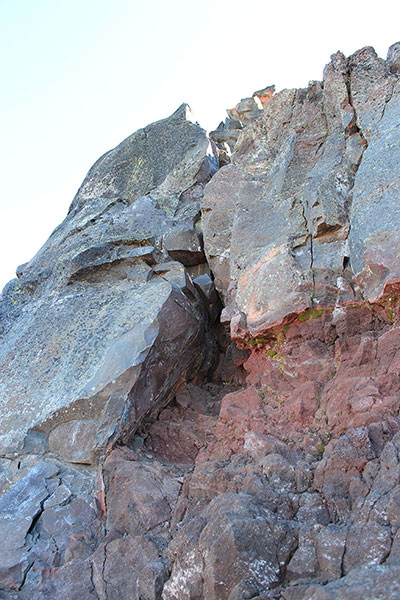
The 10-15 foot basalt wall is the crux of the climb. There are several climbing variations getting up or around the wall. My route up the wall in 2003 was less inviting this time. We watched a couple descend unroped a weakness in the wall 30 feet to our right. That route seemed shorter and easier. I decided to climb their route and Bob selected another nearby. We decided to leave our short rope, harnesses, and minimal rock gear near our packs at our lunch spot just below the wall. I carried my camera and GPS receiver for the summit.
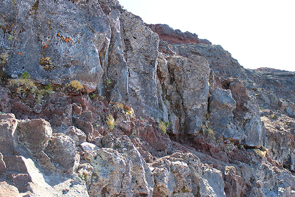
Our parallel routes up the wall proved easy to climb, but the slope above them was sandy and loose. Approaching these routes from above on descent would require care.
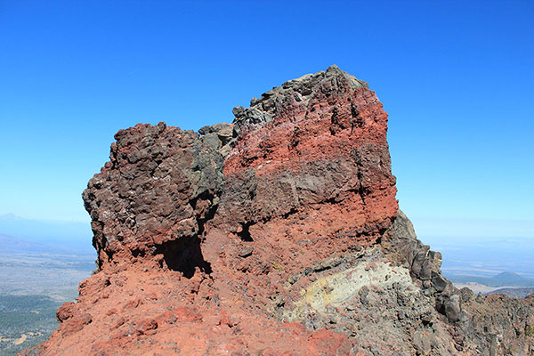
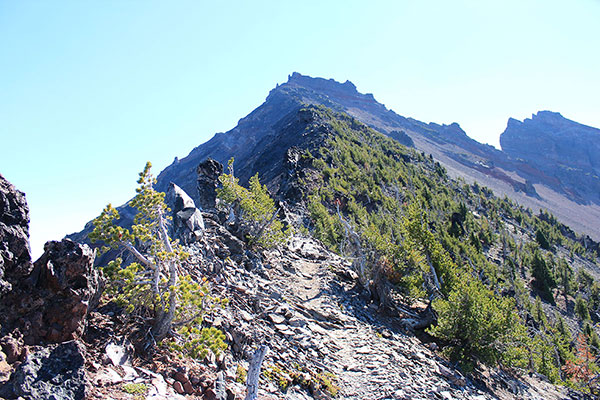
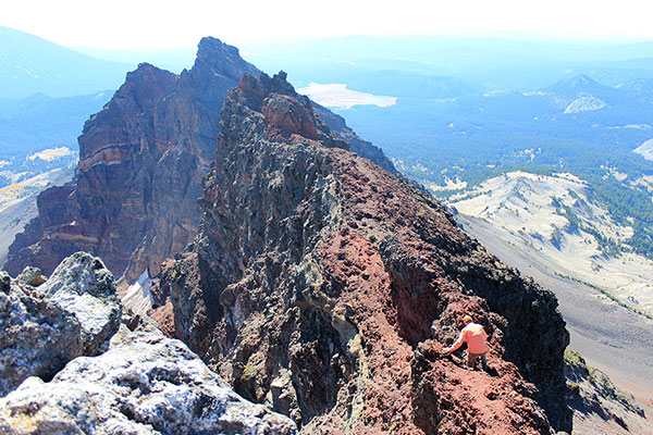
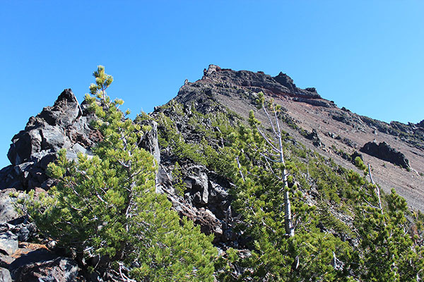
From above the wall the climbers trail traversed south below a rock wall, turned a sharp corner, and headed north along the “catwalk” to the summit rocks. The last climb to the summit was easy on firm rock.
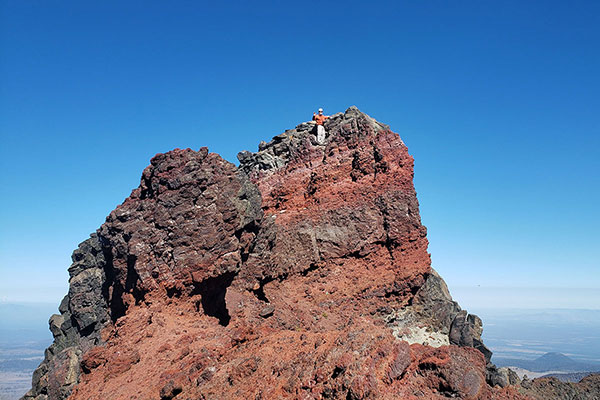
The Summit
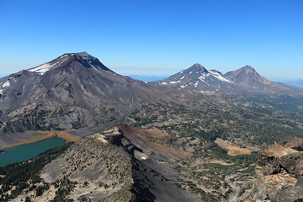
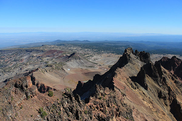
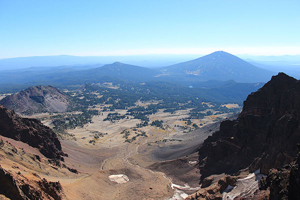
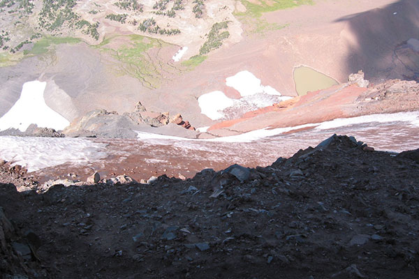
There was ample space to relax on and enjoy the summit with nice views of the Three Sisters to our northwest and Tam McArthur Rim to the northeast. The steep Southeast Ridge of Broken Top and west face of Broken Top South Peak framed our view of Tumalo Mountain, Mount Bachelor, and the Crook Glacier cirque. The sky was mostly clear but some wildfire smoke was moving in from the southwest.
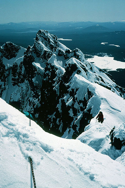
I recollected how I had led Linda and Roy up this route over snow, ice, and rock in March 1991. Linda seemed to enjoy it at the time. She was strong, confident, and trusting. She is wiser now and would not follow me up it now; I would not lead it.
The Descent
We soon started our descent. Bob led down the catwalk while I lingered for a few last photos. I followed Bob down the catwalk and footpath towards the basalt wall.
Just above the basalt wall we explored our options. Bob eventually decided to descend the sandy and loose slope down his ascent route. I choose the clean approach to the top of the route most climbers take. I descended a crack and face with many good hand and foot holds.
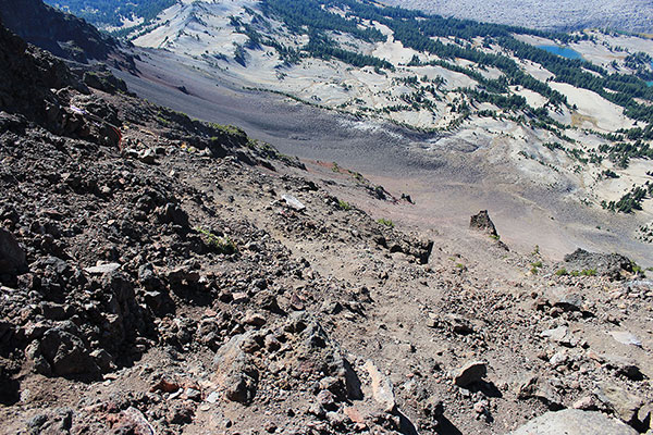
We decided to be good wilderness stewards and descend the climbers path down the northwest ridge rather than scree ski down the loose slope directly into the western cirque. Our choice proved tedious and time consuming. But I enjoyed the views up the ridge in the afternoon light.
We returned to the Green Lakes trail and hiked out to the trailhead. It seemed, as usual, that the hike out took half again as long as the hike in. I think Bob and I will return next summer. The route options are fresh in our minds now and the hike and climb is scenic and adventurous.

Leave a Reply