Late June seems to be a good time to visit the high peaks of Colorado. Then the snowpack is diminishing, the days are long, and the threat of summer thunderstorms is not yet a daily concern. In June of 2013 I visited several Colorado and Utah Peaks, specifically Mount Sneffels, Wilson Peak, and Kings Peak. I had a good time exploring more of Colorado and seeing Utah’s High Uintas for the first time.
Mount Sneffels
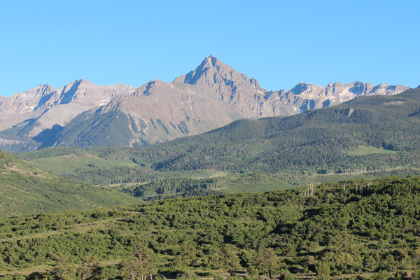
I began by driving to Ouray, Colorado and up into Yankee Boy Basin to get access to Mount Sneffels (14150′). This was my first trip with my Jeep Wrangler, and I was glad to have its clearance and traction on the rocky and trenched access road. I camped above the “first parking area”, leaving the rest of the road up to the upper trailhead for the next day.
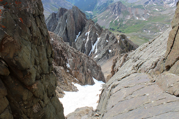
From the upper trailhead the route follows the Blue Lakes Trail a short distance and goes up a talus slope to gain Lavender Col between Mount Sneffels and “Kismet” Mountain. From the col the route follows the SE Couloir nearly to its top, goes left through the V-Notch, and up solid class 2 rock to the summit. The upper SE Couloir was filled with snow and I was glad to have brought my ice axe.
I shared the summit for a few minutes with a marmot and a pika and enjoyed excellent views of Yankee Boy Basin and nearby peaks. To the south I viewed the Wilson Group, my next destination.
Wilson Peak
After returning to camp I drove towards Telluride, then up to the Rock of Ages Trailhead for access to Wilson Peak. I found a campsite about 0.3 miles below the trailhead. Only one other party camped in the area that night.
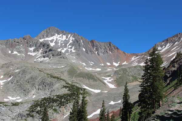
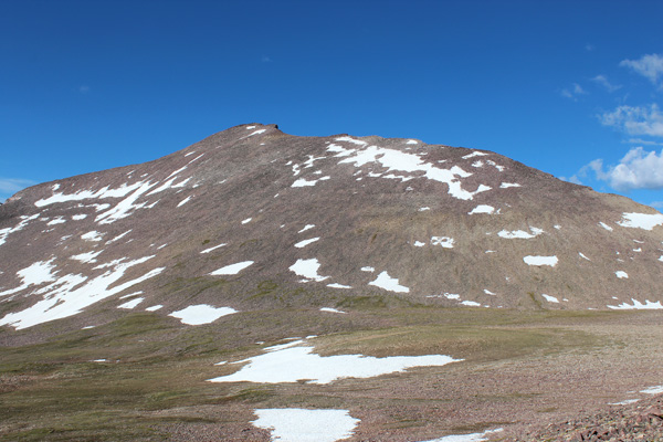
The next morning I returned to the trailhead. I followed the Rock of Ages Trail into the Silver Pick Basin, where I could see Wilson Peak (14017′) for the first time.
There were two spots on the trail (road) where steep, icy snowbanks covered the route. My ice axe gave me a lot of confidence while crossing them. From the mine buildings the route switchbacked up to the Rock of Ages Saddle, with one more icy snow traverse just below the saddle.
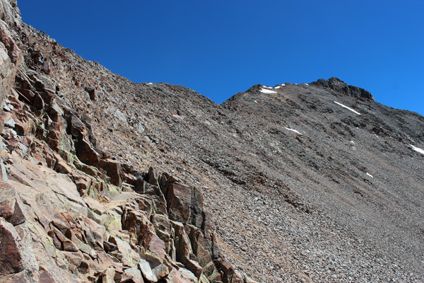
The route then traversed east to the “upper saddle”, then across some exposed class 3 rock to the SW Ridge of Wilson Peak. I hesitated at this point – the exposure and possible loose rock gave me some doubt about the prudence of continuing to solo the route. My imagination was fueled by reading many climbing accident reports over the years. I have also experienced some incidents and accidents, myself. I realized how easy it would be to let my attention wander for a moment and injure myself by stepping on a loose rock or pulling a hand hold loose.
While debating this issue, a team of local climbers arrived, and invited me to join them to finish the route. I did so, and enjoyed the rest of the climb in their company. The exposed rock sections were firm and a good boot track led across the talus traverse to the false summit. The class 3 climb to the summit was fun with several options on mostly good rock.
On the descent of Wilson Peak I weighed my options for the next climbs. Mount Wilson and El Diente Peak reportedly had more exposure than Wilson Peak and I was hesitant to commit to them solo given my doubts earlier that day. Also, it was a much higher priority for me to hike up Kings Peak, Utah’s highest, than to linger in the area and risk a change in the good weather pattern that existed at the time.
Kings Peak
So I postponed attempting the rest of the Wilson Group to another time. I drove north to Wyoming, passing through the Flaming Gorge National Recreation Area for my first time. I arrived at the Henry Fork Trailhead in the High Uintas of NE Utah on a Thursday evening.
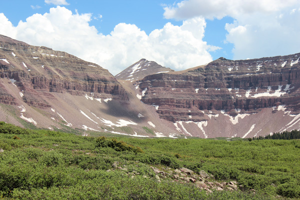
After spending the night at the trailhead campground, I backpacked in to Henry Fork Basin the next morning. The hike was very pleasant and scenic and I finally saw Kings Peak (13528′) once I entered the basin.
Dollar Lake is a popular campsite for hikers attempting Kings Peak. I searched along its southern shore for a campsite not too near other campers, but was discouraged by murky lake water and intense mosquitoes. Instead, I moved away from the lake and camped in a meadow near Henry’s Fork to the west. The mosquitoes were often intense here, as well, but when a breeze picked up I found a nice site for dinner on a nearby ridge where the mosquitoes were not as bothersome.
The next morning I left camp and continued up to Gunsight Pass. I saw a pair of climbers ahead of me, and took advantage of some of their routefinding as I traversed up the talus slopes of “West Gunsight Peak”, aka “Dome Peak” towards Anderson Pass. From this traverse I could see the final North Ridge route to the Kings Peak summit.
The clouds began to build as I arrived at Anderson Pass and met the climbing pair I had see earlier. They left almost all their gear at the pass and continued upwards. I was more tired than I thought I should have been. Perhaps I was carrying too much emergency gear, but I am a cautious person (with a vivid imagination). Perhaps the climbs earlier in the week had drained some of my energy reserves this early in the hiking season. Nevertheless, I slowly and steadily continued upwards and finally reached the summit.
By climbing Kings Peak, I had only one more “Western United States high point left to climb – Hawaii’s Mauna Kea. I have been pursuing this Western United States High Points project on and off with varying levels of commitment since the early 1980s. I had often been distracted with other projects and activities but have been getting closer in recent years. It was a scenic and satisfying experience viewing the High Uintas from Kings Peak summit.
I returned to my scenic campsite. Here I decided to pack up and hike out to the trailhead rather than spend another afternoon and evening in my hot tent at my mosquito and tick-infested campsite. I returned to the trailhead in the early evening, after a 9 mile climb and 7 mile hike out. I packed up, changed clothes, and found a motel in Evanston, Wyoming for the night.
Return Home
The temperatures were getting hot. Cities in the SW were setting record high temperatures and I realized that this could impact my last planned hike of the trip – Stevenson Benchmark near McDermitt, OR/NV. This was to be an 11-mile hike gaining about 3000 feet in open desert country (no shade). The weather forecast for McDermitt called for highs over 100 degrees. I decided it would make a better early autumn hike.
Hence my first climbing trip of summer 2013 ended with half the climbs I had tentatively planned. Nevertheless, I got good experience with my Jeep Wrangler on difficult roads, proved out a new tent and backpack, visited Utah’s highest point and nearly finished a very long-pursued climbing project. I also gained a better sense of what my level of solo climbing comfort is for planning future trips. Next up will be some bicycle tours and peakbagging trips in the Wallowas and Elkhorns of NE Oregon.

Leave a Reply