In mid September I hiked and scrambled up Red Mountain and Crown Point in the Elkhorn Mountains of NE Oregon. We are blessed with many diverse and scenic destinations to explore in Oregon. I felt renewed by the experience.
I began my trip by driving from Bend to Baker City on September 16 and checking with the Forest Service there about road conditions along the North Powder River. This is the access route I planned to use for Red Mountain and it is a popular 4WD route, though reportedly quite rocky. The prospect of driving roads like this to access peaks was the reason I purchased a Jeep Wrangler last year. The people I spoke to at the Forest Service were 4-wheelers, themselves, and described driving through the flooded road with water up to the windows. They cautioned that there might still be some flooding on the road. I left expecting an adventure.
I drove up FSR 7301 as far as a roomy and grassy hunters’ camp at 5520 foot elevation where I decided to park and camp for the night. My GPS suggested this spot was about 2 miles short of the Red Mountain Lake Trailhead, but the rocks on the road ahead were large and the steep and narrow road did not provide much room to maneuver around and over them. The campsite had good access to the North Powder River and I enjoyed a pleasant evening and night there.
The next morning, September 17, I continued hiking up FSR 7301 along the North Power River. The Red Mountain Lake Trailhead was about 2.5 miles beyond my campsite. I missed it on the first pass up the road, but spoke to a bow hunter camped beside the road and he walked me back to the trailhead. We reached the trailhead by following an unmarked road leading left (facing up river) from FSR 7301 towards the river.
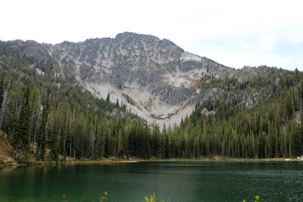
From the river’s edge I could see the trail on the other side of the narrow river. I crossed the river on downed timber slightly up river. I followed the trail up to Red Mountain Lake. Reportedly, this lake was once known as “Green Lake” and the green color of the lake explained why it was called that. Red Mountain rises 1800 feet above Red Mountain Lake and was facing me across the lake. It appeared the ridge line to the right (west) of the lake provided better and more direct access and that is the route I took, following unmaintained boot tracks and game trails where I could find them and scrambling over rock slides near the summit.
I enjoyed the summit views, identifying the peaks I had previously climbed in the Elkhorns, and studied possible access routes to Twin Mountain, my next peak destination. I descended the same route to the forest road, returned to thank the bow hunter for his help, and hiked back to my campsite. As I drove out on FSR 7301 I looked for good access roads to Twin Mountain but did not find any obvious trail or consistently open country to hike through. So after leaving the forest road I turned north and drove to the Dutch Flat Creek Trailhead and camped for the night.
The next morning, September 18, I began hiking west on Dutch Flat Creek Trail looking for a good crossing and access to Twin Mountain. Unfortunately, when I reached Dutch Flat Creek the trail was high above the creek with very steep slopes leading down to it and up the other side. So I continued hiking up the trail looking for open forest with an easier creek crossing. Instead, the trail seemed to move gradually away from the creek and Twin Mountain and the forest was dense with much downed timber. I decided I did not want to try to summit Twin Mountain from that side and returned to the trailhead. Next time I will try to summit Twin Mountain from the Elkhorn Crest Trail and Dutch Flat Lake.
I left the Dutch Flat Creek Trailhead and after exploring a forest access road up Pine Creek near Baker City I drove through Sumpter and towards Granite. At about 11 miles from Sumpter I turned right onto FSR 7370 and followed Caleb Morris’s excellent directions on SummitPost to reach the Mount Ireland Lookout Trailhead, where I parked and camped for the evening.
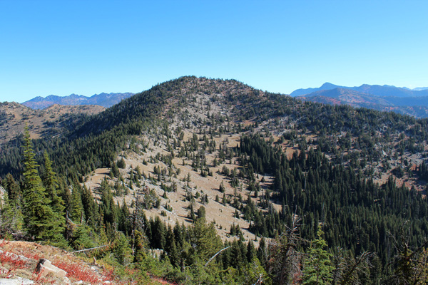
My goal the next day, September 19, was to hike Crown Point east of Mount Ireland. From camp I followed the Mount Ireland Lookout Trail to the east ridge of Mount Ireland. The trail heads up the ridge at this point to reach the lookout, but I made a descending traverse northwest through forest to a plateau at about 7400 feet near Ireland Spring. From here I traversed north upward around the east side of Peak 8022. From here I had a good view of Crown Point and the rest of my traverse. I descended to the south ridge of Crown Point and climbed the ridge to the summit.
The weather was ideal and the views of the Elkhorn Crest from Crown Point were excellent. I enjoyed identifying the several peaks I have visited and the two I have remaining. On my return I made a side trip to summit Peak 8022 before retracing my route to the trail and out to the trailhead.
I enjoyed my hikes in the Elkhorn Mountains and now have better researched plans on how to approach the remaining two peaks I want to summit in that range, Twin Mountain and Cougar Pond Peak.


Leave a Reply