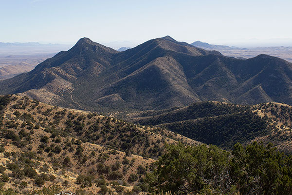
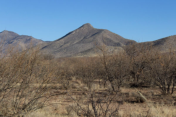
On January 21 Josef Nuernberger and I drove into the Tohono O’odham Indian Reservation (Tohono O’odham Nation) and climbed Gu Achi Peak, the highpoint of the Santa Rosa Mountains and one of the 73 Arizona peaks with at least 2000 feet of prominence. Gu Achi Peak is rarely climbed due to remoteness, lack of online access information, and a reputation for the locals being unwelcoming of visitors. With some road access research provided by Eric Kassan, Josef and I found the drive in from the south to be straightforward (with suitable maps, vehicle clearance, and good tires). The only local inhabitant we saw, in the tiny community of Sil Nakya, appeared friendly and we saw no other vehicles once we left pavement near there. Our route up the peak followed an east-ward facing ridge with mostly firm footing and which steepened near the top and provided some class 2 and 3 scrambling. The weather was ideal and the summit provided views of other Southern Arizona peaks I have visited and many more I hope to visit in the future.
We found little information about road access to Gu Achi Peak, so I have included my driving directions here. This approaches Gu Achi Peak from the south Starting on Arizona Highway 86.
Driving Directions:
- Zero your odometer at the junction of AZ 86 and Indian Road 35.
- Head north on IR 35 towards Sil Nakya.
- Pass through Schuchk. Just north of here continue straight on IR 34 towards Sil Nakya.
- At about 19 miles the pavement ends just short of Sil Nakya.
- At 19.4 miles the road curves to the left and enters Sil Nakya. Continue through Sil Nakya to the right between some buildings. Alternately, at the curve leaving into Sil Nakya you can take the fork to the right passing around Sil Nakya. In either case, continue west on IR 34.
- At 20.4 miles turn Right and head North. Gu Achi Peak will soon come into view.
- The road will eventually fork, both roads heading approximately North. We took the right fork, which remerged with the other fork later.
- At 26.2 miles arrive at a T junction with an East-West road. Turn Right and head East.
- At 26.6 miles Turn Left and head North towards Gu Achi Peak. This road is rutted in spots and becomes rockier as you continue North.
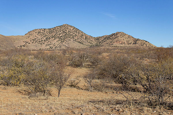
- At 30.0 miles arrive at a junction at about 2400′. We parked and started the climb here. This location is in the draw below the peak to the right in the above photo.
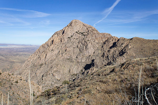
Josef and I hiked cross country towards Gu Achi Peak to the base of the ridge rising from left to right towards the summit. We then climbed this ridge to the summit.
The footing on the ridge was generally good. The summit is just left of center on the summit ridge in the above photo.
The upper portion of this ridge became rockier and we climbed over rock bands, which provided some class 2 and 3 scrambling in spots. Near the top the ridge turns slightly left and leads to the summit. There was quite a variety of brush and cacti on this route.
After climbing over a few “false summits” we reached the broad summit and found the summit cairn. We found two witness marks, but could not find the benchmark. A glass jar containing a few pieces of wet paper served as the summit registry on our visit. We signed and added a dry piece of paper to document our visit.
The summit provides open views in all directions. Looking northeast from the summit I identified Newman and Picacho Peaks. I hope to visit Newman Peak soon. To the east I identified the Silver Bell Mountains in the mid distance and the Santa Catalina and Rincon Mountains on the horizon. Coyote Mountain, Kitt Peak, and Baboquivari Peak were visible to the southeast. To the southwest we identified South Mountain which Josef had recently climbed and I hope to in the future. Beyond South Mountain we identifed the Ajo Mountains, which Linda and I plan to visit later in the winter.
Josef and I descended to my jeep and we drove out to AZ 86 the same route we had entered. We had dinner at Tiny’s, a saloon near the junction leading north to Saguaro Park West, and Josef and I parted ways for this trip. Josef continued his climbing of Arizona peaks over the next few days, maintaining a pace over many days I could not have sustained.
Leave a Reply