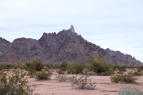
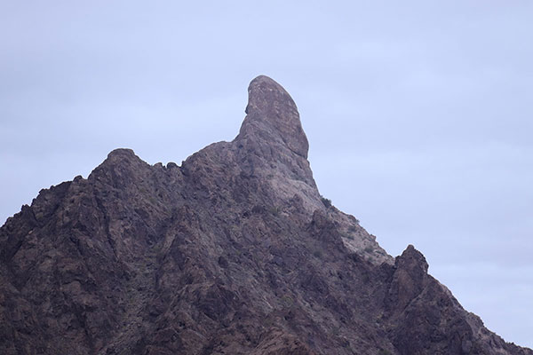
On Saturday, January 14, I attempted to climb Mohawk Peak in the Mohawk Mountains of Southwest Arizona. Mohawk Peak (Hawk Benchmark) has only 1975 feet of elevation. But it has 1435 feet of topographic prominence and a remarkable summit horn that has drawn my attention as I pass by on Interstate 8.
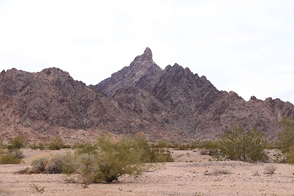
I left Tucson Saturday morning and drove to a parking spot to the north of Mohawk Peak. The weather was overcast with showers expected that evening and overnight.
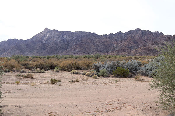
The diffuse lighting obscured the ridges and gullies from my parking spot. But I had a GPS track from a previous successful climber, Adam Walker, which I hoped would lead me up a suitable route.
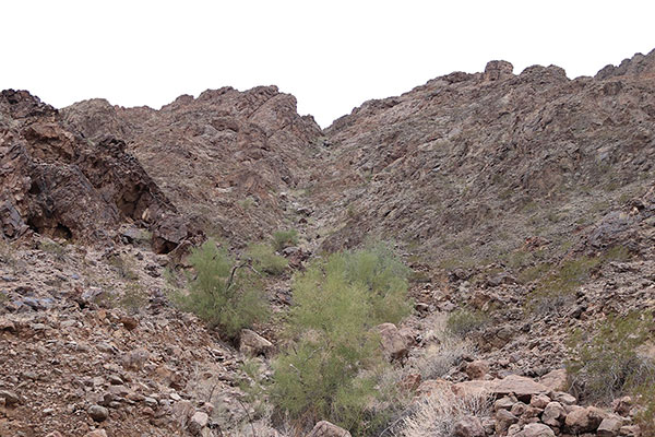
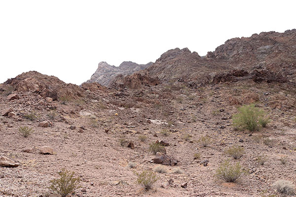
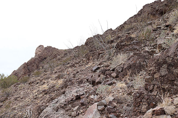
I approached the northeast face of Mohawk Peak and found the gully Adam had climbed. At first, I tried to climb slopes above the bottom of the rocky gully. Very quickly I discovered the slopes were covered in dense gravel and friable, loose rock that slipped or broke under my boots. I carefully retreated to the rocky gully bottom. Here, water had apparently washed the broken and loose rock downslope.
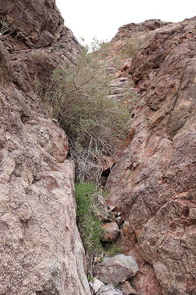
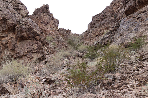
The ascent gully provided good footing and enjoyable scrambling. Sometimes I have to push through brush, but the gully was mostly open. At one spot the gully narrowed and steepened, but the rock was firm with many hand and foot holds. Wherever I climbed a steep spot I verified I could descend it later, or identified an alternate, easier option.
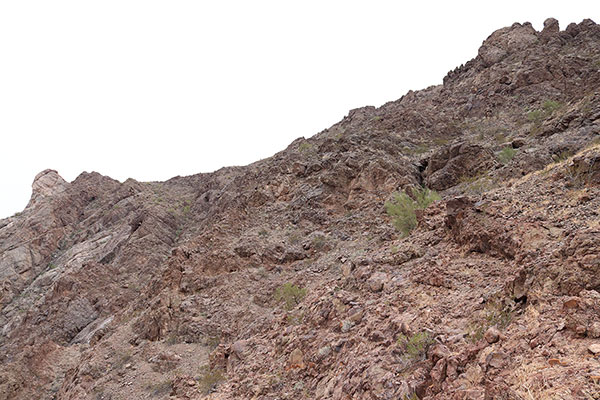
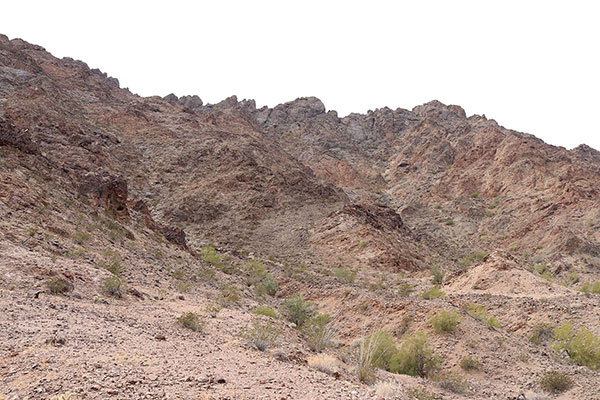
Finally I reached the top of my ascent gully and reached a saddle with a view of the summit horn up to the left and steep, likely loose towers and cliffs above me. From there I began an upward, left-hand traverse over gravel slopes and ledges and short rock bands towards the summit horn. I often glanced back to try to identify my descent route but I had my GPS receiver as a backup.
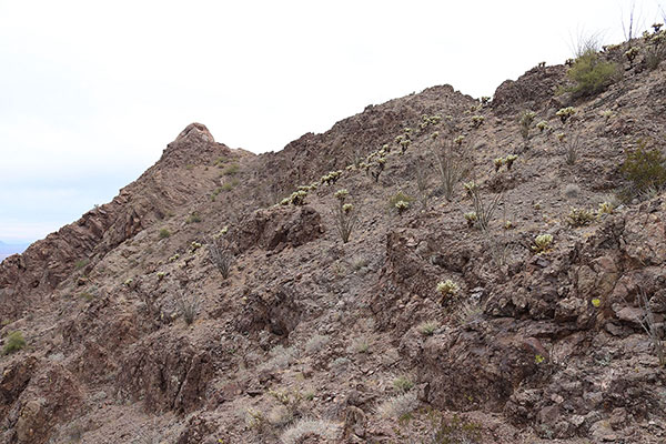
This was a slow and cautious climb. I seemed to be making progress so I kept going and eventually climbed to a saddle on the summit ridge.
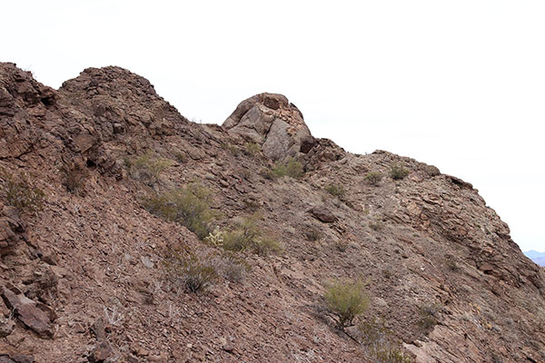
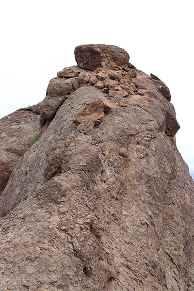
On the summit ridge I first noticed the wind and got good views of solid cloud cover threatening rain. A short walk to the southeast led me to a saddle just below the summit horn. Here I became discouraged.
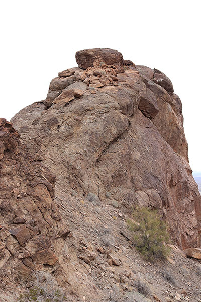
I was alone, and climbing the summit horn would have required that I climb steep slabs sloping left and right towards surely fatal falls. I could see loose rock in spots on the slabs. Larger debris higher did not look secure. So it appeared I would need to climb to the right of the larger debris and also to the right of a large capstone higher, close to threatening drops. I could not see the finish of the climb beyond the capstone from below. The wind was distracting, possible rain was worrisome, and I did not have confidence to friction climb such an exposed route in my mountaineering boots.
After a quick lunch, closer views of the start of the slabs, and weighing reward versus risk, I decided I had to turn back. Over 48 years of climbing I have missed a lot of summits through caution. But I have also been saved several times from boldness by the helpfulness and skill of climbing companions and by luck.
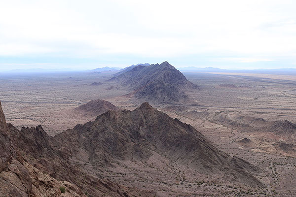
Before leaving I scanned south and west, identifying mountain ranges I visited in 2017, 2018, and 2019. I also identified the distant Tinajas Altas Mountains that I hope to visit later this month.
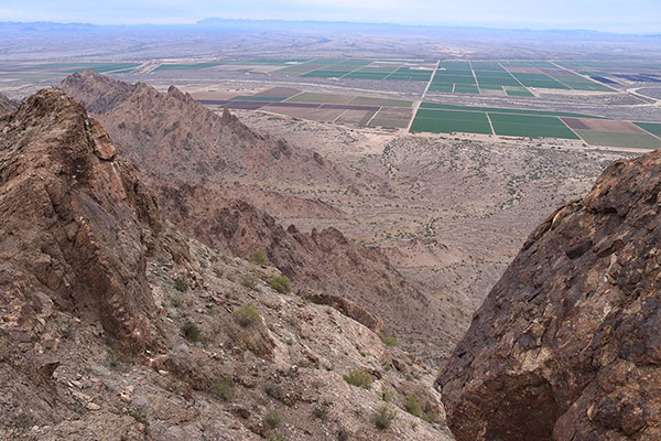
Now the goal was to traverse back down across loose slopes to my ascent gully and to descend that narrow gully before any rain might arrive. I found the top of the gully by memory and with the help of my GPS. The gully descent went well and I reached the bottom before any showers had started. The hike across the desert went well.
It was later than I had expected when I returned to my Jeep, in spite of my not having summitted. So I found a boondocking campsite near I-8 but away from any road with decent cell coverage. I mulled over the day’s experience during a pleasant evening and I slept well overnight.
Although Mohawk Peak has a lot of loose and friable rock, I thought the ascent gully was pleasant. I might return for another attempt to climb Mohawk Peak, but if so, it will be with a suitable companion in good weather and I will carry sticky rock shoes for the summit horn.

Leave a Reply