In early September I spent a week hiking several Utah prominence peaks and sampling Utah mountain ranges I had not yet visited. I began by hiking Mount Peale in the La Sal Mountains near Moab and Abajo Peak in the Abajo Mountains near Monticello. My next goal was Mount Ellen in the remote Henry Mountains south of Hanksville.
I approached the Henry Mountains with some apprehension. Mount Ellen has 5842 feet of prominence and 11522 feet of elevation, but I was not concerned about the summit route – I expected it to be a quite straightforward ridge walk. Instead, I was concerned with the remoteness of the range, the long drive on dirt and rock roads, and the possible isolation from help if I had mechanical issues. I had good directions from summitpost.org but after topping off fuel in Hanksville I stopped at the local BLM Office to learn what more I could about the route and road conditions. The BLM staff assured me that the western approach road was in good shape and the easiest on tires. I left word with Linda that if I did not check back in with her in two days that she might call the BLM office to request they check on me.
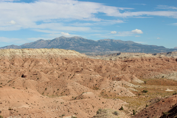
I found the western approach road and began the drive in. In the photo above the trailhead at Bull Creek Pass lies in the notch on the ridge line near the center of the photo. Mount Ellen, the high point of the Henry Mountains, is the broad summit left of that notch. The pointy peak to the left of Mount Ellen is Mount Ellen Peak. The trailhead lies 24 road miles from the junction. That afternoon I was driving in 19 miles to the McMillan Spring Campground to find a campsite.
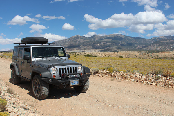
I crossed the Sandy Creek after a few miles, but it was dry and the short, steep crossing was easy in my jeep. Most of the 19 miles of dirt/rock road to McMillan Spring Campground turned out to be in good shape and while the last 3 miles to the campground were steeper and rockier the road was much better than some I have experienced elsewhere. At the campground I found several other friendly campers and found myself a roomy and quiet campsite amongst the Ponderosa pines. I was very surprised to discover I had digital cell service so I called Linda to assure her of my situation. I had only 5 more miles to drive to the trailhead the next morning and I enjoyed a quite pleasant evening and night.
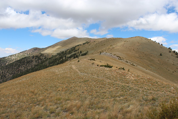
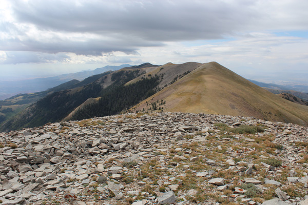
The next morning, September 4, I drove the last 5 miles of dirt/rock road to the trailhead. These last miles gained a lot of elevation but the road was easy to travel with my jeep’s clearance, 4WD, and knobby 6-ply tires. I met several ATVers above the campground and parked next to an ATV at the Mount Ellen Trailhead at Bull Creek Pass (10500 feet). In the photo above the Mount Ellen summit is about two miles away and is near the sunlit point just left of the false summit on the ridge line. It was breezy along the ridge but the temperature was ideal for hiking.
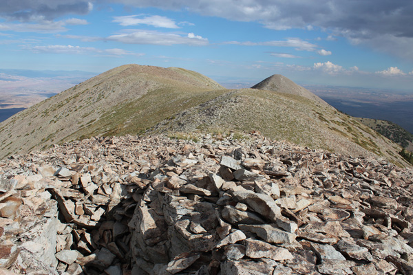
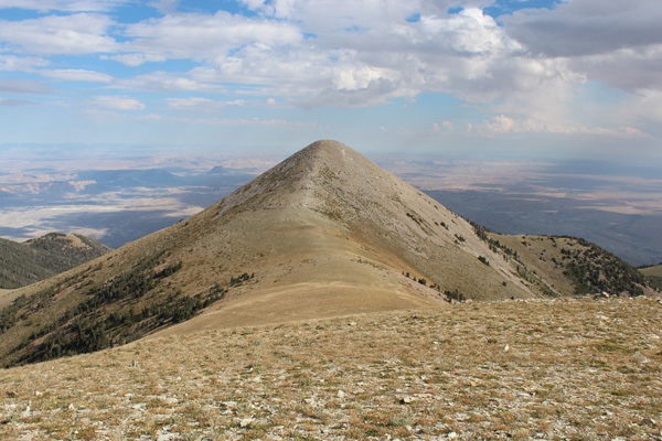
I climbed up to the false summit and saw the true summit for the first time. In the photo above the summit of Mount Ellen is on the left just a few feet higher. The cone in the distance beyond it is Mount Ellen Peak. In the foreground in front of me is one of the many excavations people have made in the talus apparently to get shelter from the wind.
I turned around and enjoyed the view of the Henry Mountains from the false summit to the south. I could just make out my jeep parked at Bull Creek Pass.
I continued and soon arrived at the summit of Mount Ellen. I found and signed a scrap of paper in the summit registry and was impressed with the many visits the peak received each year. Mount Ellen Peak rose impressively to the north and I felt compelled to include it in my hike.
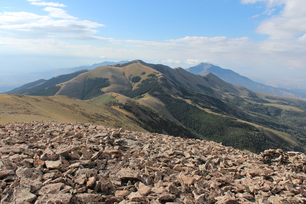
I descended to the saddle between Mount Ellen and Mount Ellen Peak and climbed upwards. Most of the climb up Mount Ellen Peak is on talus fields, but a nice trail helps considerably. Mount Ellen Peak has a summit registry that shows it is frequently visited. The summit of Mount Ellen is near the center of the photo above. The Henry Mountains stretch out to the south.
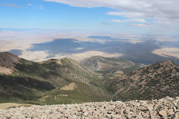
As these photos illustrate, these desert peaks are ecological “sky islands” with habitats much different from the surrounding basins. I was glad to have added the peak to my hike – it only added about two miles and 800 feet of elevation gain to my route.
I returned to the trailhead and drove out of the Henry Mountains with great satisfaction. I am quite proud of my Rubicon for how it handled the trip. The high clearance and 4WD was helpful and the 6-ply knobby tires were quite reassuring for so many miles of rock higher on the road. The experience was scenic and fun, and gave me some confidence that my jeep and I were ready to explore other remote areas in the west.

Leave a Reply