On November 16 I explored west of Marana, Arizona, and hiked and scrambled up Silver Bell Peak, the high point of the Silver Bell Mountains. Silver Bell Peak has only 4261 feet of elevation but is the 81st most prominent peak in Arizona with 1921 feet of prominence. I got good use of my Jeep on the drive in and hiked through mostly open country.
Although Silver Bell Peak is close to Tucson I was not able to find access information for it. However, I was able to map out a driving approach to the peak using topographic software and Google satellite views. I have since posted my driving directions online here. This approach route worked well for me, although the last 2.9 miles in was rocky and rutted in spots. I recommend visitors have a high-clearance 4WD vehicle with good tires.
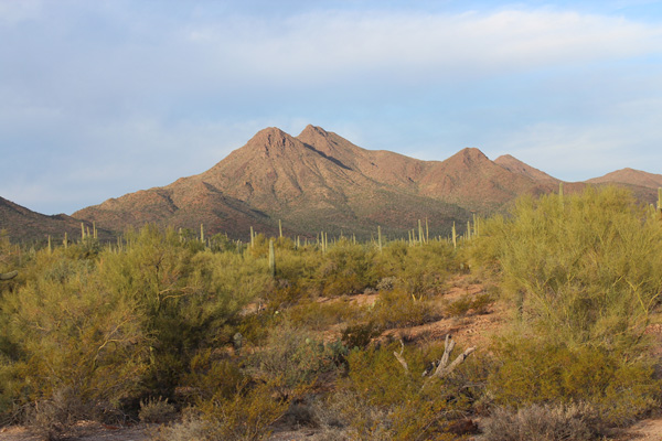
Silver Bell Peak rose ahead of me on the drive in and I stopped for photos. In the above photo the summit is the right of the two peaks just left of center. In this view I climbed the ridge along the left skyline.
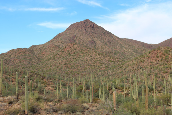
The drive ended at a wildlife water guzzler, designed to capture rainwater for wildlife. Here I parked and hiked west across open country and a minor wash to reach a saddle on the lower southeast ridge of Silver Bell Peak, to the left in the above photo.
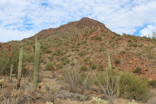
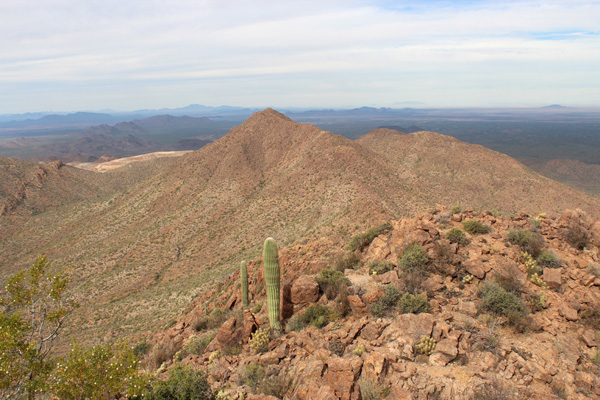
From this saddle the southeast ridge steepened above me. I climbed up over talus to reach the rocky summit ridge, topping out just left of the highest point in this view. I was glad to have sturdy boots for climbing over loose rocks. Leather gloves protected my hands from cactus spines and thorny brush.
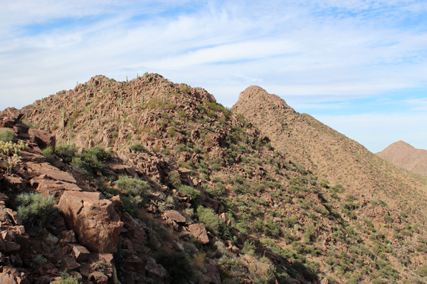
Once on the summit ridge I traversed west and northwest to the true summit just right of center in this photo. On my ascent I traversed to the right of the ridge top to avoid extra elevation gain and loss and encountered some unexpected brush. On my descent I learned it was easiest to just stay near the top of the open ridge.
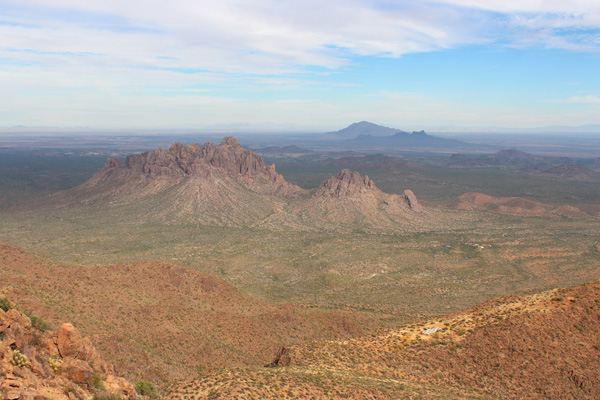
From the summit of Silver Bell Peak another peak, Silverbell Benchmark, rose to the north. Silverbell Benchmark appeared to be nearly the same elevation as Silver Bell Peak. Table Top was visible in the far distance to its left and the Sierra Estrella were just visible in the far distance to its right.
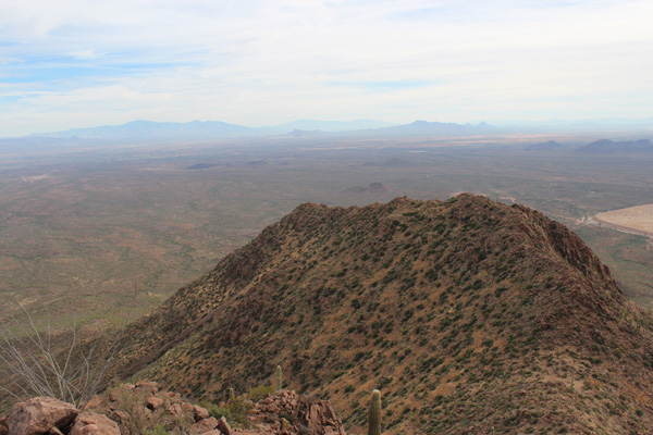
I especially enjoyed the view of Ragged Top and Newman and Picacho Peaks to the northeast. Another wildlife water guzzler was visible in the foreground below.
I looked south across the Silver Bell Mine towards Coyote Mountain, Baboquivari Peak, and Kitt Peak. These rugged mountains challenged me to visit. To the east I viewed the Santa Catalina, Rincon, and Tucson Mountains beyond my ascent ridge, rising above the Tucson Basin and my winter home.
It was satisfying to explore and successfully summit a new peak and to see so many surrounding peaks of interest to me from the summit. This was my first Arizona “prominence peak” climb of this winter season and I look forward to many more.

Paul,
While you were in the area, did you notice any adjacent mountain the locals called “S” Mountain? Apparently, some of the folks living at the company town of Silverbell painted a big “S” on it 30 or 40 years ago.
Bill,
I don’t recollect seeing an “S” painted on any surrounding peak, and I checked all my photos from my climb of Silver Bell Peak and later of Waterman Peak but did not see any in them, either.
Paul