In early September I spent a week hiking several Utah prominence peaks and sampling Utah mountain ranges I had not yet visited. I began by hiking Mount Peale in the La Sal Mountains near Moab and Abajo Peak in the Abajo Mountains near Monticello. My next goal was Mount Ellen in the remote Henry Mountains south of Hanksville.
I approached the Henry Mountains with some apprehension. Mount Ellen has 5842 feet of prominence and 11522 feet of elevation, but I was not concerned about the summit route – I expected it to be a quite straightforward ridge walk. Instead, I was concerned with the remoteness of the range, the long drive on dirt and rock roads, and the possible isolation from help if I had mechanical issues. I had good directions from summitpost.org but after topping off fuel in Hanksville I stopped at the local BLM Office to learn what more I could about the route and road conditions. The BLM staff assured me that the western approach road was in good shape and the easiest on tires. I left word with Linda that if I did not check back in with her in two days that she might call the BLM office to request they check on me.

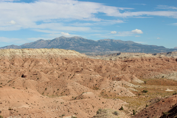
I found the western approach road and began the drive in. In the photo above the trailhead at Bull Creek Pass lies in the notch on the ridge line near the center of the photo. Mount Ellen, the high point of the Henry Mountains, is the broad summit left of that notch. The pointy peak to the left of Mount Ellen is Mount Ellen Peak. The trailhead lies 24 road miles from the junction. That afternoon I was driving in 19 miles to the McMillan Spring Campground to find a campsite.
[Read more…] about Mount Ellen, Henry Mountains, Utah