Sunday, December 13, I hiked Table Top, the high point of the Table Top Mountains in the Sonoran Desert National Monument west of Casa Grande, Arizona. Table Top is a volcanic peak with 2333 feet of prominence, making it one of the 73 Arizona peaks with at least 2000 feet of prominence. Table Top has a maintained trail leading to the SW (false) summit and an unmaintained trail leading from there to the true summit to the northeast. I enjoyed hiking the trails and viewing the surrounding mountains and valleys in clear skies and pleasant temperatures.
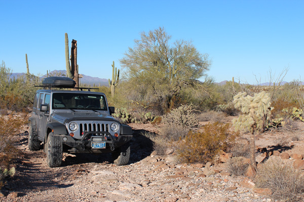
For many visitors, the challenge of visiting Table Top is driving the 11.2 miles of dirt/gravel Vekol Valley Road and 4.5 miles of dirt/rock access road to the Table Top Trailhead. There were several ruts where washes crossed the roads which required high clearance. The last few miles to the trailhead was on a rocky road with narrow passages through spiny vegetation and over an occasional cholla stem. I had no issues driving these roads with my Jeep with its excellence clearance and 10-ply tires, although I did add “Arizona Stripes” to the sides of my Jeep.
[Read more…] about Table Top, Arizona, December 2015