My Oregon’s Highest Peaks explorations has brought me back to the Wallowas of Northeast Oregon, where I last hiked and climbed 24 years ago. Linda was riding the Oregon Bicycle Ride, which passed to the north of the Wallowas, so I spent the week hiking and camping in the mountains and visited her camp in Joseph for a couple of nights.
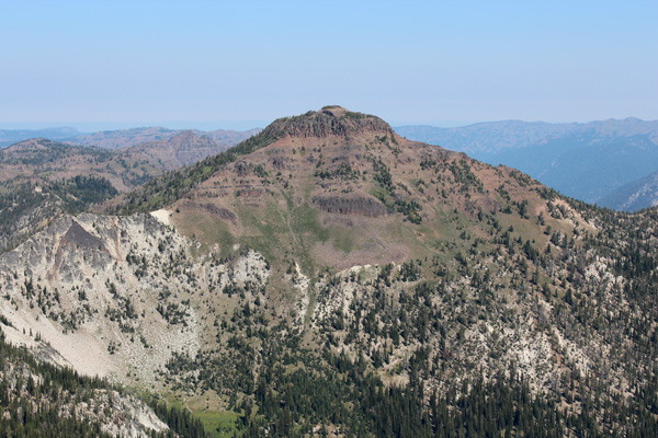
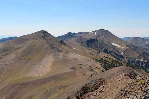
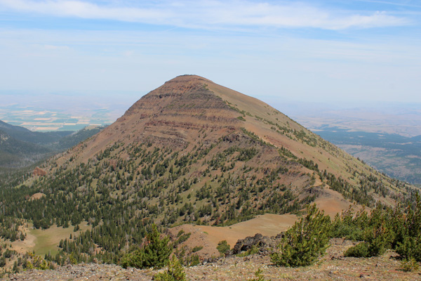
My trip began by driving out of Union up Catherine Creek and camping at the Buck Creek Trailhead. The next morning I hiked over Burger and Sand Passes and reached the summit of Granite Butte. This was my first visit to the Southern Wallowas in 41 years and the view from Granite Butte of the Wallowas was very impressive with many deep and long valleys and sharp ridgelines decorated with rocky peaks.
I retraced my route to Burger Pass, admired the fields of lupine, then gained the west ridge of China Cap, my next destination. After traversing the south face and climbing a breach in summit cliffs I gained the summit and enjoyed another view of the Southern Wallowas and met a family from La Grande out for a hike. I finished the day by returning to my car and driving through Enterprise to the Hurricane Creek Campground for the evening.
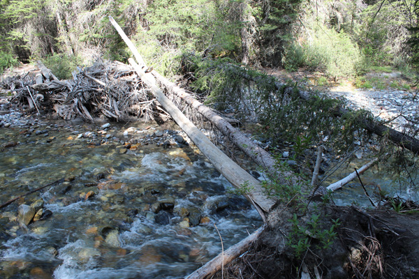
I was a bit tired the next morning but hiked south along the Hurricane Creek Trail to find the Thorpe Creek Trail, cross Hurricane Creek, and climb the Hurwal Divide. However, the Thorpe Creek Trail is not marked and I passed it once on the way up, turned around and passed it once more on the descent to where I thought it might be, forded Hurricane Creek to discover I was off route, forded the creek back and ascended again along the creek to find and explore two more trails, the last one leading to a tree crossing across the creek.
I crossed the creek on a pair of downed trees, then followed the steep trail along Thorpe Creek. After two hours of trail junction explorations and climbing about 1000 feet towards the Thorpe Creek Basin, I decided to stop for lunch, then return to the trailhead with my knowledge and photos of the correct route for another try another time.
I visited Linda at the bicycle camp that evening and camped there that night, explored along Wallowa Lake and Campground with her the next day, and after one more night in Joseph, while the bicyclists headed north, I returned to Wallowa Lake and took the Wallowa Lake Tramway up Mount Howard.
My plan this day was to traverse the ridge south from Mount Howard to summit East Peak, Hidden Peak, and Aneroid Mountain, then descend into the Aneroid Lake Basin and climb Dollar Ridge, before descending past Aneroid Lake back to Wallowa Lake. This proved to be a productive day of peakbagging.
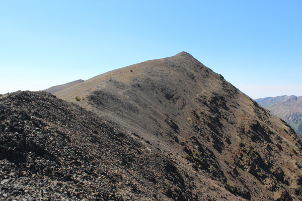
The traverse began by climbing the north ridge of East Peak on a hiker’s trail. This passed over a false summit, then on to the summit, itself. The terrain was open and the views, especially to the west, were scenic.
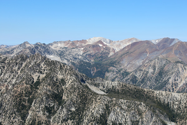
The East Peak summit rocks were swarming with flying ants, and with a long hike ahead of me I did not linger. But I did enjoy the views of the Aneroid Lake Basin below and the peaks around Ice Lake to the west, which I had last visited in 1989.
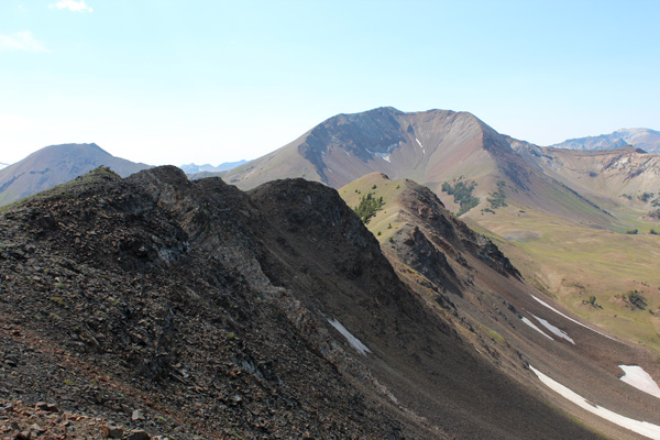
From East Peak I descended north towards Hidden Peak and Aneroid Mountain. The hiking was easy in the open country but I made many stops to identify and photograph the surrounding peaks. Mount Melissa was recognizable to the east and I planned to climb it the next day. Petes Point and Sentinel Peak to the south would be goals for another season and I considered how I might combine them in a single trip.
I encountered more flying ants on the summits of Hidden Peak and Aneroid Mountain. It is curious how they seem to congregate on summit rocks and much less so elsewhere on the ridges.
From the Aneroid Mountain summit I descended south through some minor cliffs to reach a pass above Aneroid Lake Basin and just below Dollar Ridge. This pass was open terrain with Dollar Lake and a possible future campsite nearby, but the ground was swarming with large crickets at this time, and they would have been an issue for anyone camping there.
The climb of Dollar Ridge went quickly and I got a good views of Petes Point and Aneroid Mountain from the summit. I finished the hike by descending to Aneroid Lake and down along the East Fork of the Wallowa River to Wallowa Lake. It was too late to search out a campsite and cook dinner, so I spent the night in the town of Enterprise.
The next morning I drove through Joseph to the east, then turned south on the Wallowa Mountain Loop Road (FSR 39). Linda and I have twice ridden this loop road from Joseph to Halfway on previous Oregon Bicycle Rides and I was eager to explore eastern Wallowas just west of this road. I turned west and drove to the end of a FS road to Tenderfoot Trailhead, passing private Nordic ski shelters on the way.
I hiked west on good trails into Big Sheep Basin, where the trail disappeared for a while, then climbed up onto Wing Ridge. I traversed east to tag the ridge high point and to avoid steep loose slopes, then continued north to summit Mount Melissa. Mount Melissa is the unofficial name of Point 9128 above McCully Basin, as recorded in the summit-register placed by a climbing group from Eastern Oregon University many years ago.
Mount Melissa provided a good view of the Mount Howard to Aneroid Mountain ridge traverse I had traveled the day before, and views towards Hell Canyon and the Seven Devils in Idaho to the east.
I returned to the Tenderfoot Trailhead, then continued further south on the Wallowa Mountain Loop Road to refresh my memories of that route and to seek out a campsite, eventually spending the evening and night at Lake Fork CG.
This trip reintroduced me to the Wallowas and impressed me with the wealth of opportunities for hiking and peakbagging it offers – there will be many seasons of exploring the Wallowas ahead of me.

Leave a Reply