On Friday, February 16, I met John Ohm and Dave Kohnke in Oro Valley for a climb of Nose Benchmark, a prominent peak north of Gila Bend, Arizona. This would be my second climb of the peak, but the first for them, who were considering proposing it as an addition to the long list of Southern Arizona Hiking Club peaks. Not only would this be a new peak for SAHC, but a new mountain range for SAHC as well, as the peak lies in the Gila Bend Mountains.
John drove us from Oro Valley to Gila Bend, then north to an unmarked dirt road which we followed to a parking spot below the peak. I had learned two years earlier of this access road from a local farm hand who told me it was the only road open to the public.
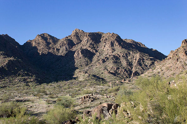
From our parking spot we hiked southwest past an abandoned mica mine towards Nose Benchmark. Our route climbed the steep northeast gully, staying on the right side where the slope seemed more stable. We reached the saddle above the gully without incident.

From this saddle we could see the summit still high above us along the rocky north ridge. We climbed the ridge then traversed right to a notch that Scott Peavy and I found on our previous climb.
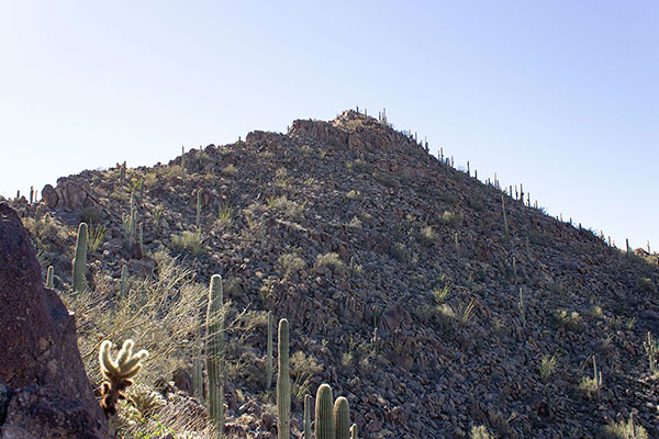
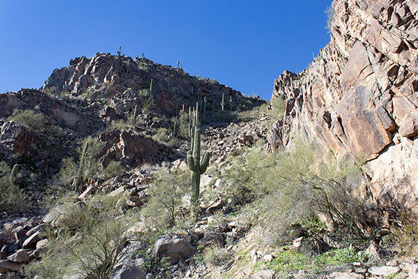
From the notch we traversed left and climbed the ridge higher just right of its crest. Near the summit a wall threatened to block access higher, but the wall offered us a narrow gateway higher that we scrambled up. From there it was easy climb to the summit.
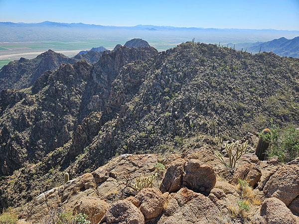
We relaxed for a short while on the summit, signing the summit registry, eating lunch, and enjoying the views. Soon we began our descent, taking the same route we had climbed to get there.
John and Dave said they enjoyed the climb and would recommend SAHC add the peak and mountain range to the club lists. Both John and Dave are recent recipients of the SAHC 400-Peak Award. Today’s climb contributed to there possibly being a SAHC 500-Peak Award in the future.

What a fabulous peak bagging hike!
I accompanied a small group of SAHC hikers to the peak in November 2025.
This post offers excellent guidance regarding the route, and the photos help to see exactly where the route goes.
The rocky ridge line made the hike interesting. A fun, somewhat challenging scramble led to the peak, where we enjoyed spectacular views.
I had often observed this range with curiosity from Highway 85. I’m pleased to have visited yet another unfamiliar mountain range in Southeast Arizona. A bit of a drive from Tucson but well worth it.
Thanks, Paul, for this excellent post.
You’re welcome, Paul! I’m glad you enjoyed the climb, and hope the public access road remains open.